Save Our Paths
Britain's campaign to save ancient footpaths

The wonderful British publication Inkcap Journal recently highlighted a government deadline to document ancient pathways (defined as appearing in maps before 1949) in England and Wales by 2026. Pathways listed will be protected, but any that are not officially registered by then will not be featured in “definitive maps” and will therefore likely be lost to history.
According to the article, since most land in England and Wales is closed to public access unless crossed by a listed footpath, if these footpaths are not registered in time it will significantly reduce public access to the countryside. Current estimates suggest that up to 49,000 miles of current footpaths are not yet listed on “definitive maps,” a huge challenge.
To solve this, hundreds of volunteers are taking the time to find these pathways and submit them for recording with local governments.
The definitive “how-to” guide for registering these paths with the British government is the book “Restoring the Record” by Sarah Bucks and Phil Wadley.
So what are these paths? Some of the most ancient are called “aggers” - old Roman raised roads that linked the settlements of Roman Britain - the civilization that flourished from the first century AD until the last legions left in 410 AD and the Anglo-Saxon sea raiders began their colonization of the British isles.
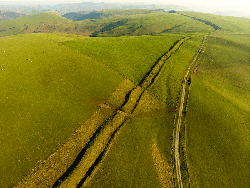
During the subsequent centuries of Anglo-Saxon dominance, these new inhabitants constructed miles of earthen mounds called dykes, likely as defensive fortifications against other tribes or against invading Danes and Norsemen. These dykes are now footpaths themselves, and criss-cross the landscape of England. The most famous of these is “Offa’s Dyke” that generally marks the cultural boundary between Anglo-Saxon Britain and the survivors of Roman Britain whom the invaders had pushed into the mountains of the west of the country and whom the newcomers called “strangers” i.e. “Welsh.”
Offa’s Dyke marking the border between England and Wales
In later more peaceful centuries, footpaths linked the settlements of medieval and early modern Britain and connected neighbor to neighbor. Pilgrim paths brought believers to local shrines and to the major cathedrals.
The charity “Slow Ways” has mapped thousands of these old routes, and is working tirelessly to get them registered in advance of the deadline.

Slow Ways’ website explains:
Slow Ways is an initiative to create a national network of walking routes connecting all of Great Britain’s towns and cities as well as thousands of villages.
Using existing paths, ways, trails and roads, people can use Slow Ways routes to walk or wheel between neighbouring settlements, and combine them to create longer distance trips. It’s designed to make it easier for people to imagine, plan and go on walking journeys.
There are currently over 7,000 Slow Ways stretching for over 100,000km. This network of routes was created by 700 volunteers during the Spring 2020 lockdown, creating a unique Slow Ways map in the process.
The next challenge in 2021 is to walk, review and verify them all - checking 100,000km of Slow Ways in the process.
Most paths in the Slow Ways network are fewer than 20km in length and pass through a village or town at least every 5km, giving travelers ample opportunity for refreshment. The initiative partners with the UK’s Ordnance Survey (the rough equivalent of the US Geological Survey) to add the paths to the Ordnance Survey’s detailed maps.
The initiative and its founder - geographer Dan Raven-Ellison - has received extensive coverage in the British press, as well as a profile in National Geographic. Raven-Ellison is an official National Geographic Explorer, and can be followed at his own website, ravenellison.com. He previously produced the popular short films “UK in 100 Seconds,” “UK National Parks in 100 Seconds,” and “Netherlands in 100 Seconds.”
While walking each of these Slow Ways may never be as popular as more well-known routes in Europe, we wish this initiative all the best. After all, the Camino was largely in disuse until the 1980s. Likewise, this weekend (24 July) marks the 25th anniversary of the opening of the “Thames Path,” a 184 mile path along the Thames River from its source to its mouth. Its current popularity could likely not have been foreseen by its planners.
As Chaucer, one of England’s first and best-known trail walkers put it, these things tend to develop “as an ook cometh of a litel spyre.” Or in other words, “Mighty oaks from little acorns grow.” Here’s to the continued success of Britain’s Slow Ways!